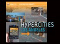
<?xml version="1.0" encoding="UTF-8"?>
<rss version="2.0"
	xmlns:content="http://purl.org/rss/1.0/modules/content/"
	xmlns:wfw="http://wellformedweb.org/CommentAPI/"
	xmlns:dc="http://purl.org/dc/elements/1.1/"
	xmlns:atom="http://www.w3.org/2005/Atom"
	xmlns:sy="http://purl.org/rss/1.0/modules/syndication/"
	xmlns:slash="http://purl.org/rss/1.0/modules/slash/"
	>

<channel>
	<title>Hypercities</title>
	<atom:link href="http://hypercities.com/feed/" rel="self" type="application/rss+xml" />
	<link>http://hypercities.com</link>
	<description>Main blog for Hypercities</description>
	<lastBuildDate>Wed, 08 May 2013 20:23:09 +0000</lastBuildDate>
	<language>en-US</language>
	<sy:updatePeriod>hourly</sy:updatePeriod>
	<sy:updateFrequency>1</sy:updateFrequency>
	<generator>http://wordpress.org/?v=3.5.1</generator>
		<item>
		<title>NEH Summer Institute at UCLA: Digital Cultural Mapping (June 18-July 6, 2012)</title>
		<link>http://hypercities.com/blog/2011/12/16/neh-summer-institute-at-ucla-digital-cultural-mapping-june-18-july-6-2012/</link>
		<comments>http://hypercities.com/blog/2011/12/16/neh-summer-institute-at-ucla-digital-cultural-mapping-june-18-july-6-2012/#comments</comments>
		<pubDate>Fri, 16 Dec 2011 19:57:47 +0000</pubDate>
		<dc:creator>presner</dc:creator>
				<category><![CDATA[Uncategorized]]></category>

		<guid isPermaLink="false">http://hypercities.com/?p=696</guid>
		<description><![CDATA[Directed by: Todd Presner, Diane Favro, and Chris Johanson &#160; Please visit http://hypercities.com/NEH for the full schedule &#160; We are pleased to announce the 12 participants in the 2012 NEH Summer Institute for Advanced Topics in the Digital Humanities: Ryan Cordell (English, Northeastern University), “Networks and Textual Histories of the ‘Celestial Railroad.’” Jonathan Massey (School [...]]]></description>
				<content:encoded><![CDATA[<p>
Directed by: Todd Presner, Diane Favro, and Chris Johanson</p>
<p>&nbsp;</p>
<p>Please visit <a href="http://hypercities.com/NEH" target="_blank">http://hypercities.com/NEH</a> for the full schedule</p>
<p>&nbsp;</p>
<p>We are pleased to announce the 12 participants in the 2012 NEH Summer Institute for Advanced Topics in the Digital Humanities:<strong></strong></p>
<p><strong>Ryan Cordell</strong> (English, Northeastern University), “Networks and Textual Histories of the ‘Celestial Railroad.’”</p>
<p><strong>Jonathan Massey</strong> (School of Architecture, Syracuse University), “Occupying Wall Street: Places and Spaces of Political Action”</p>
<p><strong>John Maciuika</strong> (Art and Architectural History, CUNY—Baruch College), “Berlin Palace Reconstruction, Urban Development, and the Cartographic Imagination”</p>
<p><strong>Jennifer Reut </strong>(Smithsonian National Museum of African American History and Culture, Postdoctoral Scholar),  “Mapping a Landscape of African American Travel, 1944-1964: Invisibility, Mobility and Autonomy”</p>
<p><strong>Paula R. Lupkin</strong> (independent scholar), “Mapping the Great Southwest”</p>
<p><strong>Nobuko Toyosawa</strong> (History, USC), “A Digital Mapping of <em>Placing Japan: National Imaginaries and the Formation of Historical Knowledge in the Tokugawa and Meiji Eras</em>.”</p>
<p><strong>Gabriel Hankins</strong> (University of Virginia Scholars Lab, Graduate Fellow), “Mapping Modernism”</p>
<p><strong>Annie Danis</strong> (independent scholar), “Mapping the
<div><a href='http://buygenericviagraonlinee.com/' title='generic viagra reviews'>generic viagra reviews</a></div>
<p> Rainbow Bridge Monument Valley Expedition”</p>
<p><strong>Lillian Manzor </strong>(Modern Languages, University of Miami),  “Miami Through its Spanish Performing Arts Spaces”</p>
<p><strong>Niall Atkinson</strong> (Art History, University of Chicago) and <strong>Peter Leonard</strong> (Director, Humanities Research Computing, University of Chicago), “Renaissance Cartography / Renaissance Chorography: Florence in Census and Senses”</p>
<p><strong>Angel David Nieves
<div><a href='http://cialisss.com/' title='generic cialis'>generic cialis</a></div>
<p> </strong>(Africana Studies, Hamilton College), “The Soweto HGIS Project: Cartographies of Apartheid and Resistance in the Spatial Humanities”</p>
<p>&nbsp;</p>
<p>The purpose of the Institute is to bring together a cohort of 12 Humanities scholars and advanced graduate students across various disciplines to learn how to develop innovative publications and courses that harness the theoretical and practical approaches of the “geospatial Humanities.”  By geospatial Humanities, we mean the centrality of place, geo-temporal analysis, and mapping for conceptualizing, investigating, and visualizing research problems in fields such as history, architecture, classics, literary studies, art history, as well as the humanistic social sciences (archaeology, anthropology, and political science). Situated at the intersection of critical cartography and information visualization, the Institute will combine a survey of the “state of the art” in interoperable geospatial tools and publication models, with hands-on, studio-based training in integrating GIS data into Humanities scholarship, developing spatial visualizations, and deploying a suite of mapping tools in the service of creating publication-ready research articles and short monographs with robust digital components.</p>
<div></div>
]]></content:encoded>
			<wfw:commentRss>http://hypercities.com/blog/2011/12/16/neh-summer-institute-at-ucla-digital-cultural-mapping-june-18-july-6-2012/feed/</wfw:commentRss>
		<slash:comments>1</slash:comments>
		</item>
		<item>
		<title>HyperCities Los Angeles Launches</title>
		<link>http://hypercities.com/blog/2011/08/29/hypercities-los-angeles-launches/</link>
		<comments>http://hypercities.com/blog/2011/08/29/hypercities-los-angeles-launches/#comments</comments>
		<pubDate>Mon, 29 Aug 2011 17:47:11 +0000</pubDate>
		<dc:creator>presner</dc:creator>
				<category><![CDATA[Uncategorized]]></category>

		<guid isPermaLink="false">http://hypercities.com/?p=662</guid>
		<description><![CDATA[With the generous support of the John Randolph Haynes and Dora Haynes Foundation, the HyperCities Los Angeles Research Collection has launched. The “Los Angeles Research Collection” empowers citizens and researchers to use the tools of interactive &#8220;time mapping.&#8221; With HyperCities, you can explore social, cultural, and political history in Los Angeles over time. The site [...]]]></description>
				<content:encoded><![CDATA[
<div>
<div>
<div>
<p>With the generous support of the John Randolph Haynes and Dora Haynes Foundation, <a title="HyperCities LA" href="http://hypercities.com/la" target="_blank">the HyperCities Los Angeles Research Collection</a> has launched.<br />
The “Los Angeles Research Collection” empowers citizens and  researchers to use the tools of interactive &#8220;time mapping.&#8221;  With HyperCities, you can explore social, cultural, and political history in Los Angeles over time.  The site can be accessed from a web-browser in any school, community center, government office, home, and  academic setting, allowing citizens to delve into and create their own collections of  mappable knowledge and cultural heritage.  Community-generated content exists side-by-side with scholar-produced research data, thereby creating new interactions between traditionally separated domains of knowledge.</p>
<p><img class="alignleft size-medium wp-image-663" src="http://hypercities.com/files/2011/08/la2-300x167.jpg" alt="" width="383" height="213" /></p>
<p>A centerpiece of the Los Angeles Research Collection is the “Pdub” collection of materials from Historic Filipinotown. Built by the  Pilipino Worker’s Center (PWC), a community service organization serving  LA’s Historic Filipinotown (“Hi Fi”), and Public Matters, a public  history design and educational media partnership,  “Pdub Productions” is  an innovative project using new media as a way to connect with, explore  and promote Hi Fi’s rich history and culture.  The collection brings to life historical maps of the region using the voices, narratives, and videos of generations of people who live in the neighborhood.  In addition to featuring a trove of archival materials relating to the history of the region, it also provides viewers with a cultural map of the present-day neighborhood.</p>
<p>Social Scientists have contributed several important datasets as  seed-beds for the planned growth of the Los Angeles Research  Collections.  One is the Los
<div><a href='http://ccialisonlinee.com' title='cialis cheapest price'>cialis cheapest price</a></div>
<p> Angeles County Union Census Tract Data  Series, 1940-2000 (Los Angeles: University of Southern California,  2000-2006), created under the leadership of Philip Ethington and Dowell  Myers, and consisting of 438 variables, for the years 1940-2000. With this data, users can track the demographic history of any census track in Los Angeles county over the past sixty years, or examine shifts in ethnic composition, median income, education level, age, occupation,
<div><a href='http://sale-viagra-off.com/'>viagra canada</a></div>
<p> and more.  The  Voting and Demographic Data for the 2001 and 2005 Mayoral Elections in  the City of Los Angeles, contributed by Mark Drayse and Raphael  Sonenshein of CSU Fullerton, was funded by the Russell Sage Foundation; the Annual Immigration Data Aggregated to ZIP Code level data set was  assembled by Ali Modarres of CSU Los Angeles.  HyperCities supplies the  connective links between these separate collections and allows  researchers, scholars, and community groups to access and utilize these  data through a common online platform.</p>
<p>The &#8220;HiFi&#8221; collection is a &#8220;Featured Collection&#8221; &#8212; but users can also create their own collections using the publicly available data or &#8220;mix-and-match&#8221; historical maps and other collections from the HyperCities site.  To do so, simply close the HiFi collection (click the box in the upper-right corner) and begin exploring the historical maps and collections.  You can always return to HiFi under &#8220;featured collections&#8221; (click the book icon to see the full narrative view of the collection).  Over the next year, we will be dramatically expanding the LA collections with new featured collections on neighborhoods such as Boyle Heights and more demographic data-sets.</p>
<p><img class="alignleft size-medium wp-image-664" src="http://hypercities.com/files/2011/08/la7-300x172.jpg" alt="" width="389" height="223" /></p>
</div>
</div>
</div>
]]></content:encoded>
			<wfw:commentRss>http://hypercities.com/blog/2011/08/29/hypercities-los-angeles-launches/feed/</wfw:commentRss>
		<slash:comments>1</slash:comments>
		</item>
		<item>
		<title>How to Navigate a HyperCities Collection</title>
		<link>http://hypercities.com/blog/2011/07/14/how-to-navigate-a-hypercities-collection/</link>
		<comments>http://hypercities.com/blog/2011/07/14/how-to-navigate-a-hypercities-collection/#comments</comments>
		<pubDate>Thu, 14 Jul 2011 17:13:10 +0000</pubDate>
		<dc:creator>David Shepard</dc:creator>
				<category><![CDATA[How To]]></category>

		<guid isPermaLink="false">http://hypercities.com/?p=653</guid>
		<description><![CDATA[Image 1: Landing view of a HyperCities Collection. &#160;The column on the right is called &#8220;Narrative View.&#8221; &#160;The dark panel at the top is the main collection header, containing a brief general overview or introduction to the collection as a whole. &#160;In the yellow band, you can operate the &#8220;Next&#8221; and &#8220;Previous&#8221; buttons to advance [...]]]></description>
				<content:encoded><![CDATA[
<div><img class="aligncenter size-full wp-image-654" src="http://hypercities.com/files/2011/07/HyperCities_How-To_Navigate_A_Collection_001.jpg" alt="Landing View of a Collection" width="720" height="554" /></div>
<div>Image 1: Landing view of a HyperCities Collection. &nbsp;The column on the right is called &#8220;Narrative View.&#8221; &nbsp;The dark panel at the top is the main collection header, containing a brief general overview or introduction to the collection as a whole. &nbsp;In the yellow band, you can operate the &#8220;Next&#8221; and &#8220;Previous&#8221; buttons to advance forward or backward through the objects. &nbsp;In this collection, the objects are all contained inside subcollection folders. &nbsp;Clicking on the subcollection folders opens those folders and reveals the objects and sometimes other subcollections.</div>
<p style="text-align: center"><img class="aligncenter size-full wp-image-655" src="http://hypercities.com/files/2011/07/HyperCities_How-To_Navigate_A_Collection_002.jpg" alt="" width="720" height="554" /></p>
<p>Image 2: After opening a sub-collection, the map will re-locate to the site associated with the first object, which is highlighted. Use the Left-pointing arrow at the top of Narrative View, in the dark-colored sub-collection header, to return to the main collection. &nbsp;Click on objects directly to view them and to re-locate the associated maps, or advance with the &#8220;Next&#8221; and &#8220;Prev&#8221; buttons.</p>
<p><img class="aligncenter size-full wp-image-656" src="http://hypercities.com/files/2011/07/HyperCities_How-To_Navigate_A_Collection_003.jpg" alt="Collection options" width="720" height="554" /></p>
<p>Image 3: Various options are available while viewing a collection. &nbsp;A, B, C and D operate on the Google Maps/Google Earth navigation and mode. &nbsp;The &#8220;x&#8221; box labeled &#8220;E&#8221; in this image will close the current collection and return you to the general HyperCities environment. &nbsp;You can
<div><a href='http://compra-viagra-onlinee.com/'>compra viagra online</a></div>
<p> return to this collection from there by clicking on the &#8220;back&#8221; button on your browser.</p>
<p><img class="aligncenter size-full wp-image-657" src="http://hypercities.com/files/2011/07/HyperCities_How-To_Navigate_A_Collection_004.jpg" alt="" width="720" height="554" /></p>
<p>Image 4: Click the center button (F) to center the map on the selected object&#8217;s default view. Click the checkbox (G) to turn that rich object on. Clicking anywhere on the textual description of an object will switch to that rich object and check the checkbox; clicking on the checkbox of an object other than the one that you are currently viewing will turn on the objects and maps in addition to the objects and maps of the object you are currently viewing.</p>
<p><img class="aligncenter size-full wp-image-658" src="http://hypercities.com/files/2011/07/HyperCities_How-To_Navigate_A_Collection_005.jpg" alt="" width="720" height="554" /></p>
<p>Image 5: If Sync Map (H) is on, HyperCities will attempt to find a historical map for the object you are viewing if the object does not already have a historical map connected to it. This is off by default because many objects already have historical maps associated with them. Time format (I) adjusts the format of the time displayed in each object; it defaults to &#8220;date.&#8221; Auto ZoomIn (J) changes the map view to the view associated with each object as it is selected; this is on by default. 3D buildings (K) controls whether
<div><a href='http://viagracanadale.com/' title='viagra canadian pharmacy'>viagra canadian pharmacy</a></div>
<p> Google Earth&#8217;s own provided 3D buildings are displayed in Earth mode, and defaults to off.</p>
]]></content:encoded>
			<wfw:commentRss>http://hypercities.com/blog/2011/07/14/how-to-navigate-a-hypercities-collection/feed/</wfw:commentRss>
		<slash:comments>1</slash:comments>
		</item>
		<item>
		<title>Presner delivers Plenary lecture at Coalition for Networked Information</title>
		<link>http://hypercities.com/blog/2011/05/26/presner-delivers-plenary-lecture-at-coalition-for-networked-information/</link>
		<comments>http://hypercities.com/blog/2011/05/26/presner-delivers-plenary-lecture-at-coalition-for-networked-information/#comments</comments>
		<pubDate>Thu, 26 May 2011 15:55:43 +0000</pubDate>
		<dc:creator>presner</dc:creator>
				<category><![CDATA[Uncategorized]]></category>

		<guid isPermaLink="false">http://hypercities.com/?p=644</guid>
		<description><![CDATA[Todd Presner delivers the keynote lecture at the Coalition for Networked Information (April buy viagra 2011): &#8220;HyperCities; Using Social Media and GIS to Archive and Map cialis generico india Time-Layers in Berlin, Los Angeles, Rome, Tehran, and Cairo.&#8221;]]></description>
				<content:encoded><![CDATA[<p>
Todd Presner delivers the keynote lecture at the Coalition for Networked Information (April
<div><a href='http://viagraforsalefb.com/' title='buy viagra'>buy viagra</a></div>
<p> 2011): &#8220;HyperCities; Using Social Media and GIS to Archive and Map
<div><a href='http://comprare-cialis-online.com/'>cialis generico india</a></div>
<p> Time-Layers in Berlin, Los Angeles, Rome, Tehran, and Cairo.&#8221;</p>
<p></p>
]]></content:encoded>
			<wfw:commentRss>http://hypercities.com/blog/2011/05/26/presner-delivers-plenary-lecture-at-coalition-for-networked-information/feed/</wfw:commentRss>
		<slash:comments>0</slash:comments>
		</item>
		<item>
		<title>How to Add an ArcGIS Server Map to a Rich Object</title>
		<link>http://hypercities.com/blog/2011/05/19/how-to-add-an-arcgis-ma/</link>
		<comments>http://hypercities.com/blog/2011/05/19/how-to-add-an-arcgis-ma/#comments</comments>
		<pubDate>Thu, 19 May 2011 23:51:43 +0000</pubDate>
		<dc:creator>David Shepard</dc:creator>
				<category><![CDATA[How To]]></category>

		<guid isPermaLink="false">http://hypercities.com/?p=626</guid>
		<description><![CDATA[If you have a map hosted on an ArcGIS Server, it&#8217;s possible to display that as part of a rich object in HyperCities. These maps will show up when a user views the rich object as part of the narrative. Here&#8217;s how: 1) Get the URL of the map&#8217;s MapServer service. This always ends in [...]]]></description>
				<content:encoded><![CDATA[
<div>If you have a map hosted on an ArcGIS Server, it&#8217;s possible to display that as part of a rich object in HyperCities. These maps will show up when a user views the rich object as part of the narrative. Here&#8217;s how:</div>
<div>1) Get the URL of the map&#8217;s MapServer service. This always ends in /MapServer. In the example below, this is akbash.ats.ucla.edu:8399/arcgis/rest/services/Haynes/Mayoral_Election_2005/MapServer. You can find this by browsing the ArcGIS Server Services Directory:</div>
<div><img class="aligncenter size-large wp-image-633" src="http://hypercities.com/files/2011/05/arcgis-server-1024x1019.jpg" alt="A picture of a map service in the ArcGIS Server Services Directory" width="1024" height="1019" /></div>
<div>2) To add the map to HyperCities, create an object as normal. In the Add Media
<div><a href='http://viagraonline-store.net/'>viagra vs cialis</a></div>
<p> frame, click on the maps tab.</p></div>
<div><img class="aligncenter size-full wp-image-635" src="http://hypercities.com/files/2011/05/before-clicking-map-tab-2.jpg" alt="" width="728" height="376" /></div>
<div>3) You will see a text box in the middle of the pane to enter the URL you just copied from the ArcGIS Server.</div>
<div><img class="aligncenter size-full wp-image-636" src="http://hypercities.com/files/2011/05/map-list-and-text-box.jpg" alt="" width="723" height="469" /></div>
<div></div>
<div>Type in or paste the URL of the map service here:</div>
<div></div>
<div><img class="aligncenter size-full wp-image-637" src="http://hypercities.com/files/2011/05/paste-url.jpg" alt="" width="638" height="108" /></div>
<div>4) If you would like to use specific layers from the map service, add a slash (&#8220;/&#8221;) to the URL, then the layer numbers, each one separated by a comma. For example, akbash.ats.ucla.edu:8399/arcgis/rest/services/Haynes/Mayoral_Election_2005/MapServer/6,17.</div>
<div><img class="aligncenter size-full wp-image-638" src="http://hypercities.com/files/2011/05/past-url-with-layers.jpg" alt="" width="643" height="102" /></div>
<div>5) Click on the &#8220;Plus&#8221; icon next to it. A map marked &#8220;WS Map&#8221; (for &#8220;webservice map&#8221;) will show up in the frame above it. If this was the correct URL, the map will then be overlaid on top of the HyperCities map. Loading the actual images of the map may take some time, up to 30 seconds. Please wait for the map image to be overlaid onto the map before moving onto the next step.</div>
<div><img class="aligncenter size-large wp-image-639" src="http://hypercities.com/files/2011/05/layer-displayed-1024x625.jpg" alt="" width="1024" height="625" /></div>
<div>6) To remove the map or adjust its opacity, click on the arrow next to the map URL in the frame above the text box. This will show a box with controls for doing both of these things.</div>
<div><img class="aligncenter size-full wp-image-640" src="http://hypercities.com/files/2011/05/opacity-and-remove-panel-detail.jpg" alt="" width="205" height="91" /></div>
<div>7) To add another map service, follow the same steps. You can delete the text in the URL bar once you&#8217;ve added the first map, but this is not necessary.</div>
<div><img class="aligncenter size-full wp-image-641" src="http://hypercities.com/files/2011/05/second-map.jpg" alt="" width="638" height="111" /></div>
<div>Please note: Maps entered this way are not added to HyperCities&#8217; map database, but linked to the individual objects users add them to. This feature may be implemented later.</div>
]]></content:encoded>
			<wfw:commentRss>http://hypercities.com/blog/2011/05/19/how-to-add-an-arcgis-ma/feed/</wfw:commentRss>
		<slash:comments>0</slash:comments>
		</item>
		<item>
		<title>HyperCities Now: Linking GIS and Twitter (Japan, Egypt, Libya)</title>
		<link>http://hypercities.com/blog/2011/05/07/hypercities-now-linking-gis-and-twitter-japan-egypt-libya/</link>
		<comments>http://hypercities.com/blog/2011/05/07/hypercities-now-linking-gis-and-twitter-japan-egypt-libya/#comments</comments>
		<pubDate>Sat, 07 May 2011 14:50:02 +0000</pubDate>
		<dc:creator>presner</dc:creator>
				<category><![CDATA[Uncategorized]]></category>

		<guid isPermaLink="false">http://hypercities.com/?p=584</guid>
		<description><![CDATA[Three HyperCities Now Maps by Yoh Kawano Japan Crisis Commons Data Layers Map created by HyperCities collaborator, Yoh Kawano. HyperCities Now Crisis Map focused on Japan Earthquake (linking twitter and GIS) &#8212; needs Google Earth plugin. HyperCities Sendai: Live streaming and archival map of tweets from Sendai since March 10, 2011 &#8211; Visualization of 700,000 [...]]]></description>
				<content:encoded><![CDATA[<p> Three HyperCities Now Maps by Yoh Kawano</p>
<p><a href="http://gis.ats.ucla.edu/japan/" target="_blank">Japan Crisis Commons Data Layers Map</a> created by HyperCities collaborator, Yoh Kawano.</p>
<p><a href="http://hypercities.ats.ucla.edu/#collections/41962">HyperCities Now Crisis Map</a> focused on Japan Earthquake (linking twitter and GIS) &#8212; needs Google Earth plugin.</p>
<p><a title="http://sendai.hypercities.com" href="http://sendai.hypercities.com" target="_blank">HyperCities Sendai: </a>Live streaming and archival map of tweets from Sendai since March 10, 2011</p>
<p>&#8211; <a href="http://analysis.hypercities.com/" target="_blank">Visualization </a>of 700,000 tweets from Japan, 450,000 from Libya, and 400,000 from Egypt (search parameters are based on
<div><a href='http://viagrapills-store.com/'>trusted tablets</a></div>
<p> keyword and displayed as data visualization over time).  Choose twitter archive, keyword, and visualization type.  Note: will take about 30 seconds to initially query DB and load visualization.</p>
<p><a rel="attachment wp-att-586" href="http://hypercities.com/blog/2011/05/07/hypercities-now-linking-gis-and-twitter-japan-egypt-libya/screen-shot-2011-05-07-at-10-28-21-am/"></a><a rel="attachment wp-att-586" href="http://hypercities.com/blog/2011/05/07/hypercities-now-linking-gis-and-twitter-japan-egypt-libya/screen-shot-2011-05-07-at-10-28-21-am/"><img class="alignleft size-full wp-image-586" src="http://hypercities.com/files/2011/05/Screen-shot-2011-05-07-at-10.28.21-AM.png" alt="" width="562" height="321" /></a></p>
<p>May 6-7, 2011: <a href="http://gis.harvard.edu/icb/icb.do?keyword=k235&amp;pageid=icb.page420114" target="_blank">Links </a>to Presner and Kowano Harvard presentation at Center for Geographic Analysis</p>
]]></content:encoded>
			<wfw:commentRss>http://hypercities.com/blog/2011/05/07/hypercities-now-linking-gis-and-twitter-japan-egypt-libya/feed/</wfw:commentRss>
		<slash:comments>0</slash:comments>
		</item>
		<item>
		<title>HyperCities Egypt Featured on NBC LA</title>
		<link>http://hypercities.com/blog/2011/02/11/hypercities-egypt-featured-on-nbc-la/</link>
		<comments>http://hypercities.com/blog/2011/02/11/hypercities-egypt-featured-on-nbc-la/#comments</comments>
		<pubDate>Sat, 12 Feb 2011 03:49:27 +0000</pubDate>
		<dc:creator>David Shepard</dc:creator>
				<category><![CDATA[Uncategorized]]></category>

		<guid isPermaLink="false">http://hypercities.com/?p=560</guid>
		<description><![CDATA[Yesterday, an NBC news crew visited UCLA to do a story about HyperCities Egypt. Today, the story was featured on &#60;a href=&#34;http://www.nbclosangeles.com/news/local-beat/UCLA-Project-Eavesdrops-on-Egypt-twitter-hypercities-115943429.html&#34; target=&#34;_blank&#8221;&#62;NBC LA. The story contains a video interview with Yoh Kawano buy flagyl explaining the project. This has resulted in coverage for HyperCities from as far away as the Times of India. We [...]]]></description>
				<content:encoded><![CDATA[<p> Yesterday, an NBC news crew visited UCLA to do a story about HyperCities Egypt. Today, the story was featured on &lt;a href=&quot;http://www.nbclosangeles.com/news/local-beat/UCLA-Project-Eavesdrops-on-Egypt-twitter-hypercities-115943429.html&quot; target=&quot;_blank&#8221;&gt;NBC LA</a>. The story contains a <a href="http://www.nbclosangeles.com/news/local-beat/UCLA_Project__Eavesdropping_on_Egypt_Los_Angeles-115949004.html" target="_blank">video interview with Yoh Kawano</a>
<div><a href='http://flagylonlinee.com/' title='buy flagyl'>buy flagyl</a></div>
<p> explaining the project. This has resulted in coverage for HyperCities from as far away as the <a href="http://timesofindia.indiatimes.com/topic/article/0du28Oo3KX21f?q=University+of+California%2C+Los+Angeles" target="_blank">Times of India</a>. <span style="font-size: small">We are grateful to NBC for covering our project and for generating so much attention for HyperCities, and are excited that people continue to find the project exciting
<div><a href='http://viagraenligne-1st.com/'>pharmacie en ligne</a></div>
<p> and informative.</span></p>
<p><span style="font-size: small"> </span></p>
<p style="text-align: center"></p>
]]></content:encoded>
			<wfw:commentRss>http://hypercities.com/blog/2011/02/11/hypercities-egypt-featured-on-nbc-la/feed/</wfw:commentRss>
		<slash:comments>1</slash:comments>
		</item>
		<item>
		<title>HyperCities Egypt: Voices from Cairo through Social Media</title>
		<link>http://hypercities.com/blog/2011/02/08/new-project-hypercities-egypt/</link>
		<comments>http://hypercities.com/blog/2011/02/08/new-project-hypercities-egypt/#comments</comments>
		<pubDate>Wed, 09 Feb 2011 01:38:16 +0000</pubDate>
		<dc:creator>David Shepard</dc:creator>
				<category><![CDATA[Uncategorized]]></category>

		<guid isPermaLink="false">http://hypercities.com/?p=550</guid>
		<description><![CDATA[HyperCities has released a new buy viagra no prescription project for mapping tweets sent by protesters in Cairo during the recent crisis. The project, &#8220;HyperCities Egypt: Voices from Cairo through Social Media,&#8221; tracks tweets since January 30, and continues to collect tweets sent from within Cairo that mention hashtags relevant to the protests, such as [...]]]></description>
				<content:encoded><![CDATA[<p> HyperCities has released a new <u><a href='http://buyviagrac.com/' title='buy viagra no prescription'>buy viagra no prescription</a></font> project for mapping tweets sent by protesters in Cairo during the recent crisis. The project, &#8220;HyperCities Egypt: Voices from Cairo through Social Media,&#8221; tracks tweets since January 30, and continues to collect tweets sent from within Cairo that mention hashtags relevant to the protests, such as #jan25 or #egypt. We hope that this project will both make the experience of the protests more immediate to users in other parts of the world, and provide an archive useful for historians, political scientists and scholars in media and communication studies. The project has been featured in a <a href="http://newsroom.ucla.edu/portal/ucla/ucla-unveils-digitial-archive-191921.aspx" target="_blank">UCLA Newsroom article</a> and has received attention from<a href="http://twitter.com/#search?q=hypercities"> the Twitter community</a>.</p>
<p><img class="aligncenter size-full wp-image-558" src="http://hypercities.com/files/2011/02/Egypt-Screenshot.jpg" alt="Screenshot of HyperCities Egypt" width="500" height="298" /></p>
<p>The tweets&#8217; location is based on the locations that Twitter users provide in their profiles, or GPS coordinates supplied by mobile devices. To protect users, coordinates supplied by
<div><a href='http://farmacia247.net/'>farmacia italiana</a></div>
<p> mobile devices are truncated so that they are only accurate to about a kilometer when they are displayed. The database stores more accurate locations, but these are currently not visible to the public.</p>
<p>The project is the brainchild of Todd Presner, Yoh Kawano, and David Shepard. It is based on a tool Kawano had previously developed for mapping tweets, which Shepard and Kawano modified to display tweets from a specific area relating to specific topics, and added the archiving feature. Source code will be available for download and modification soon.</p>
<p>To view the project, visit <a href="http://egypt.hypercities.com/">http://egypt.hypercities.com/</a>.</p>
]]></content:encoded>
			<wfw:commentRss>http://hypercities.com/blog/2011/02/08/new-project-hypercities-egypt/feed/</wfw:commentRss>
		<slash:comments>3</slash:comments>
		</item>
		<item>
		<title>Visualizing Statues in the Late Antique Roman Forum Released</title>
		<link>http://hypercities.com/blog/2011/01/04/inscriptions-project-goes-liv/</link>
		<comments>http://hypercities.com/blog/2011/01/04/inscriptions-project-goes-liv/#comments</comments>
		<pubDate>Wed, 05 Jan 2011 04:27:05 +0000</pubDate>
		<dc:creator>David Shepard</dc:creator>
				<category><![CDATA[Featured Collections]]></category>

		<guid isPermaLink="false">http://hypercities.com/?p=543</guid>
		<description><![CDATA[Visualizing Statues in the Late Antique Roman Forum, a new HyperCities project, has just been released. Funded by a grant from the National Endowment for the Humanities, the project explores the purpose and use of statues of Roman emperors in the fourth and fifth centuries CE. These statues were located at precise spots in the [...]]]></description>
				<content:encoded><![CDATA[<p> Visualizing Statues in the Late Antique Roman Forum, a new HyperCities project, has just been released. Funded by a grant from the National Endowment for the Humanities, the project explores the purpose and use of statues of Roman emperors in the fourth and fifth centuries CE. These statues were located at precise spots in the urban landscape, and depended greatly on the surrounding terrain for effect; they illustrated continuities across the generations of rulers, and processions through the area implicitly brought absent rulers into the company of their predecessors, preserving memories of the political and military roles played by emperors.</p>
<p style="text-align: center"><a href="http://inscriptions.etc.ucla.edu" target="_blank"><img class="size-medium wp-image-576 aligncenter" src="http://hypercities.com/files/2011/01/GSA16-300x168.jpg" alt="" width="450" height="252" /></a></p>
<p>The late antique statues of the emperors from the Roman Forum have disappeared over the millennia; this project returns each statue to its original context, within a large model of the Roman Forum. The project includes a map of all the statues and a database of all the inscriptions upon each statue; it also uses HyperCities&#8217; guided tours to take the user through the statues from different perspectives, including a set of views that illustrates the significance of emperor Honorius&#8217;
<div><a href='http://cialis-generic-ed.com/'>cialis online</a></div>
<p> procession at ground level.</p>
<p>Visualizing Statues in the Late Antique Roman Forum is the result of collaborative efforts among faculty members, and builds on other research done at UCLA. It uses the <a href="http://dlib.etc.ucla.edu/projects/Forum">&#8220;Digital Roman Forum</a>&#8220;, a model of the forum developed by the UCLA <a href="http://www.etc.ucla.edu/">Experiential Technologies Center</a>, which was completed in 2005. The Digital Roman Forum project led to an NEH-supported Summer Institute at UCLA entitled “Models of Ancient Rome,” taught by Professor Diane Favro together with Sander Goldberg and Chris Johanson. One outcome of the seminar was a series of discussions about ways to continue the research on the Roman Forum by focusing on the experiential issues raised by statues and the ritual use of public space during late antiquity. Through the Fellowships at Digital Humanities Centers program, the NEH funded Gregor Kalas’s year-long research at UCLA’s Experiential Technologies
<div><a href='http://genericviagrain.com/'>cheap viagra</a></div>
<p> Center to pursue this research in collaboration with Favro and Johanson.</p>
<p>To view the project, please visit <a href="http://inscriptions.etc.ucla.edu/">http://inscriptions.etc.ucla.edu/</a>.</p>
]]></content:encoded>
			<wfw:commentRss>http://hypercities.com/blog/2011/01/04/inscriptions-project-goes-liv/feed/</wfw:commentRss>
		<slash:comments>0</slash:comments>
		</item>
		<item>
		<title>How to Create a Rich Object</title>
		<link>http://hypercities.com/blog/2010/09/10/how-to-create-a-rich-object/</link>
		<comments>http://hypercities.com/blog/2010/09/10/how-to-create-a-rich-object/#comments</comments>
		<pubDate>Fri, 10 Sep 2010 18:46:32 +0000</pubDate>
		<dc:creator>manok</dc:creator>
				<category><![CDATA[How To]]></category>

		<guid isPermaLink="false">http://hypercities.com/?p=494</guid>
		<description><![CDATA[Unlike a regular object, a Rich Object isn&#8217;t just a specific region in space and time. A Rich Object is more useful for storytelling. It allows the creator to configure the viewport in a specific way to show the reader a particular configuration of maps and objects. Its real power emerges in narrative mode. To [...]]]></description>
				<content:encoded><![CDATA[<p> Unlike a regular object, a Rich Object isn&#8217;t just a specific region in space and time. A Rich Object is more useful for storytelling. It allows the creator to configure the viewport in a specific way to show the reader a particular configuration of maps and objects. Its real power emerges in narrative mode.</p>
<p>To understand the difference, let&#8217;s go through the features of a regular object. It has:</p>
<ul>
<li>A defined region on the map</li>
<li>A specific timespan</li>
<li>A title</li>
<li>Descriptive text, images, video, etc.</li>
</ul>
<p>To this, a rich object adds:</p>
<ul>
<li>A specific view in the viewport (center point and zoom level in 2D mode; tilt, pan, etc. in 3D mode).</li>
<li>One or two historic maps, whose transparency can be set</li>
<li>A specific base map (such as a satellite map or a blank map); you may also set it to open in Earth mode</li>
<li>A set of objects or collections that are turned on</li>
<li>The ability to set which object has a bubble on over it, and the state (minimized or maximized) of that bubble</li>
</ul>
<p>Creating a rich object uses the same interface as creating a regular object; it just requires using more features. It can be any of the basic types of objects (point, line, polygon) or even a KML link. This tutorial will cover features common to creating all rich objects. Here&#8217;s how to do it.</p>
<p>First,<em><strong> <span style="font-style: normal">without</span></strong></em> clicking the Add Media Button, use the Map List to select the maps you would like to have on in the background. You can change which maps you have on later, but you can&#8217;t change their transparency. As usual with HyperCities, you may select up to two maps. The maps will always show up with the last one you selected on top.</p>
<p><a rel="attachment wp-att-497" href="http://hypercities.com/blog/2010/09/10/how-to-create-a-rich-object/screen1/"><img class="alignnone size-full wp-image-497" src="http://hypercities.com/files/2010/09/screen1.jpg" alt="" width="700" /></a></p>
<p>Once the map is on, set the transparency using the transparency slider, or leave it totally opaque.<br />
<a rel="attachment wp-att-502" href="http://hypercities.com/blog/2010/09/10/how-to-create-a-rich-object/screen2/"><img class="alignnone size-full wp-image-502" src="http://hypercities.com/files/2010/09/screen2.jpg" alt="" width="700" /></a></p>
<p>Now, using the Collection List, you may also select the objects you want to turn on with your rich object. You have the option to change this later.<br />
<a rel="attachment wp-att-505" href="http://hypercities.com/blog/2010/09/10/how-to-create-a-rich-object/screen3/"><img class="alignnone size-full wp-image-505" src="http://hypercities.com/files/2010/09/screen3.jpg" alt="" width="700" /></a></p>
<p>Now, click on the Add Media button as you would regularly to create a normal <u><a href='http://buycialisonline-khui.com/'>cialis online</a></font> object. Once you draw the shape you would like to have, the Add Media panel will pop up. Fill in the fields as you would normally; if you&#8217;re creating a KML network link, paste the URL into the appropriate field.</p>
<p>In addition to the regular options, you will see the options &#8220;Select Base Map&#8221; and &#8220;Select Other Items&#8221; here (hover over the buttons if you&#8217;re unsure which is which). You can see both of these in the picture below. The &#8220;Select Base Map&#8221; button allows you to delete or add more map to your object; however, you can no longer set the transparency of the maps you choose from this point. This has to be done in the Map List.</p>
<p><a rel="attachment wp-att-511" href="http://hypercities.com/blog/2010/09/10/how-to-create-a-rich-object/screen5/"><img class="alignnone size-full wp-image-511" src="http://hypercities.com/files/2010/09/screen5.jpg" alt="" width="700" /></a></p>
<p>The &#8220;Select Other Items&#8221; button lets you select more items you want to turn on with your rich object. You can also uncheck items that you have chosen earlier.</p>
<p>If you would like to have an object show up with its info bubble open, click on the object. You may also expand the info bubble.<br />
<a rel="attachment wp-att-508" href="http://hypercities.com/blog/2010/09/10/how-to-create-a-rich-object/screen4/"><img class="alignnone size-full wp-image-508" src="http://hypercities.com/files/2010/09/screen4.jpg" alt="" width="700" /></a></p>
<p>Also, adjust the viewport as you would like your reader to see it, as you would normally with Google Maps or Google Earth. The view will be preserved exactly as you leave it. You may also choose whether the object will be viewed on Satellite, Map, Hybrid, Terrain, Earth, or even on a completely blank map; do this using the map type selector in the upper-right hand corner of the map (it says &#8220;Earth&#8221; in the picture below).</p>
<p><a rel="attachment wp-att-514" href="http://hypercities.com/blog/2010/09/10/how-to-create-a-rich-object/screen6/"><img class="alignnone size-full wp-image-514" src="http://hypercities.com/files/2010/09/screen6.jpg" alt="" width="700" /></a></p>
<p>Once you&#8217;re finished making these adjustments, select one or more collections to put your new Rich Object inside, and click the &#8220;Save&#8221; button. When you click &#8220;Save&#8221;, the entire state of the object at that point &#8212; maps, viewport, objects, etc. &#8212; will be saved.</p>
<p>To view the rich object you have created, view the collection where it was saved in &#8220;Narrative Mode.&#8221; Each object should open the view exactly as you left it.</p>
<p>To edit the object, edit it as you would a regular object (find it in a collection, check it on, and click the edit button). The viewport will adjust to reflect the way you left it. Please note that any adjustments you make to the viewport will be saved at the moment
<div><a href='http://buycialis-online-ed.com/'>cialis vs viagra</a></div>
<p> you click &#8220;Save.&#8221;</p>
]]></content:encoded>
			<wfw:commentRss>http://hypercities.com/blog/2010/09/10/how-to-create-a-rich-object/feed/</wfw:commentRss>
		<slash:comments>0</slash:comments>
		</item>
	</channel>
</rss>
